

![]() Image-Recognition Flight Plans – For Search Aircraft, Helicopters & Drones
Image-Recognition Flight Plans – For Search Aircraft, Helicopters & Drones
Overview:
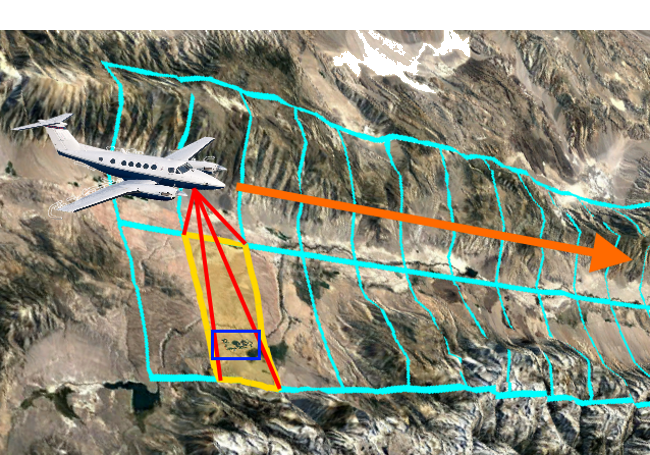
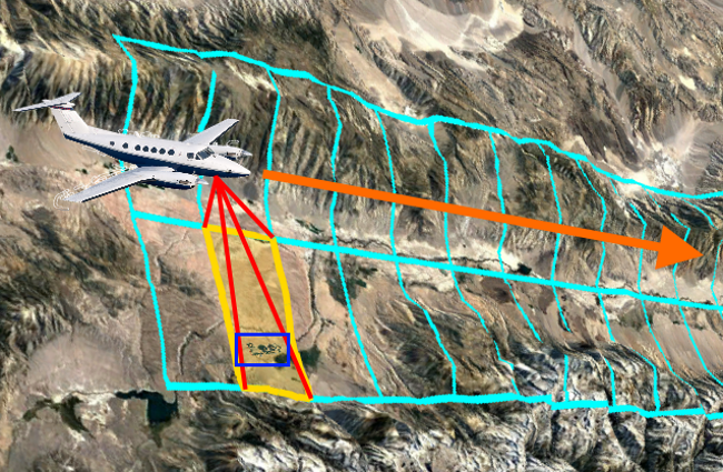
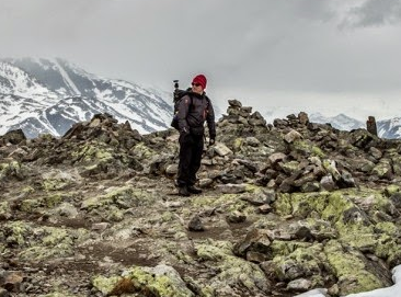
![]() Aerial searching for target objects requires careful planning and precise flying.
Aerial searching for target objects requires careful planning and precise flying.
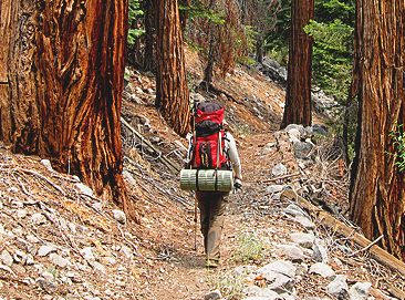
Aerial searching with digital cameras permits advanced image recognition to subsequently process, analyze and identify the target object.
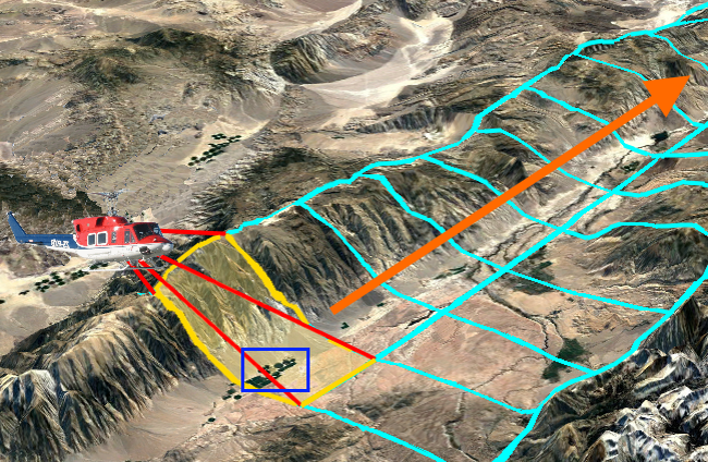
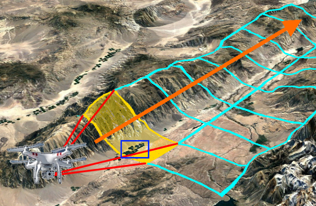
To perform a successful Image-Recognition Flight both the aircraft and camera’s parameters must be precisely matched to ensure the highest probability of locating, imaging and then detecting the target object.
To meet these challenging requirements SAR Technology’s Optimized Flight Plans create a detailed Image-Recognition Flight Plan for each search aircraft type – to ensure that the most accurate and successful flight is performed.
![]()
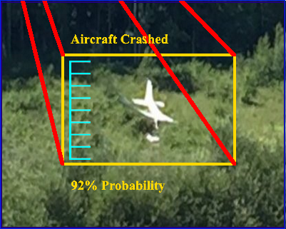
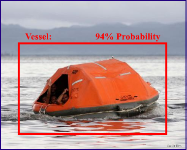
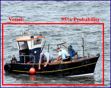
SAR Technology’s Image-Recognition may then be used to scan the flight’s images to help find the target object within the image collection.
Tip: Perform a short ‘Calibration Circuit’ at the beginning of each flight at the specified altitude AGL, making sure that known-size objects, such as roads or vehicles, are included in the images taken. This will help later in selecting the number of segments for image-recognition scans.
![]()
![]()
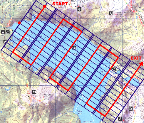
![]() Optimized Search-Aircraft Flight Plans – for all types of Missing Targets (Recommended)
Optimized Search-Aircraft Flight Plans – for all types of Missing Targets (Recommended)
![]()
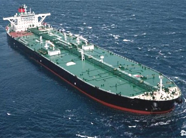
![]() Search-Aircraft Flight Plans – for Missing Aircraft, Helicopters and Vessels. (unoptimized)
Search-Aircraft Flight Plans – for Missing Aircraft, Helicopters and Vessels. (unoptimized)
![]()
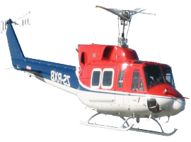
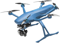
![]() Search-Helicopter Flight Plans – for Missing Persons and Vehicles. (unoptimized)
Search-Helicopter Flight Plans – for Missing Persons and Vehicles. (unoptimized)
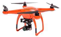
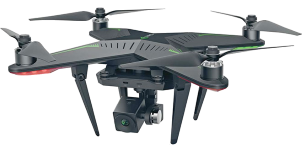
![]() Search-Drone Flight Plans – for Missing Persons. (unoptimized)
Search-Drone Flight Plans – for Missing Persons. (unoptimized)
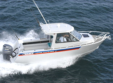
![]() Search-Aircraft Flight Plans – for Missing Aircraft, Helicopters & Vessels
Search-Aircraft Flight Plans – for Missing Aircraft, Helicopters & Vessels
![]()
Quick Set-Up for Missing Aircraft & Helicopters
![]() Quick Set-Up for Missing Vessels under 30m
Quick Set-Up for Missing Vessels under 30m ![]() Quick Set-Up for Missing Vessels over 30m
Quick Set-Up for Missing Vessels over 30m
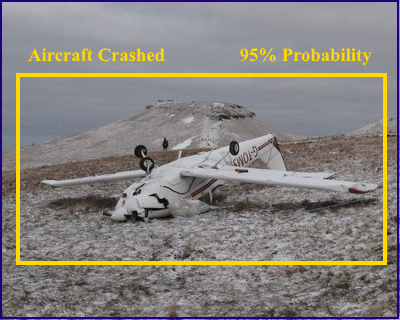
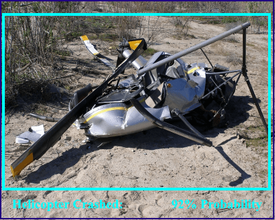
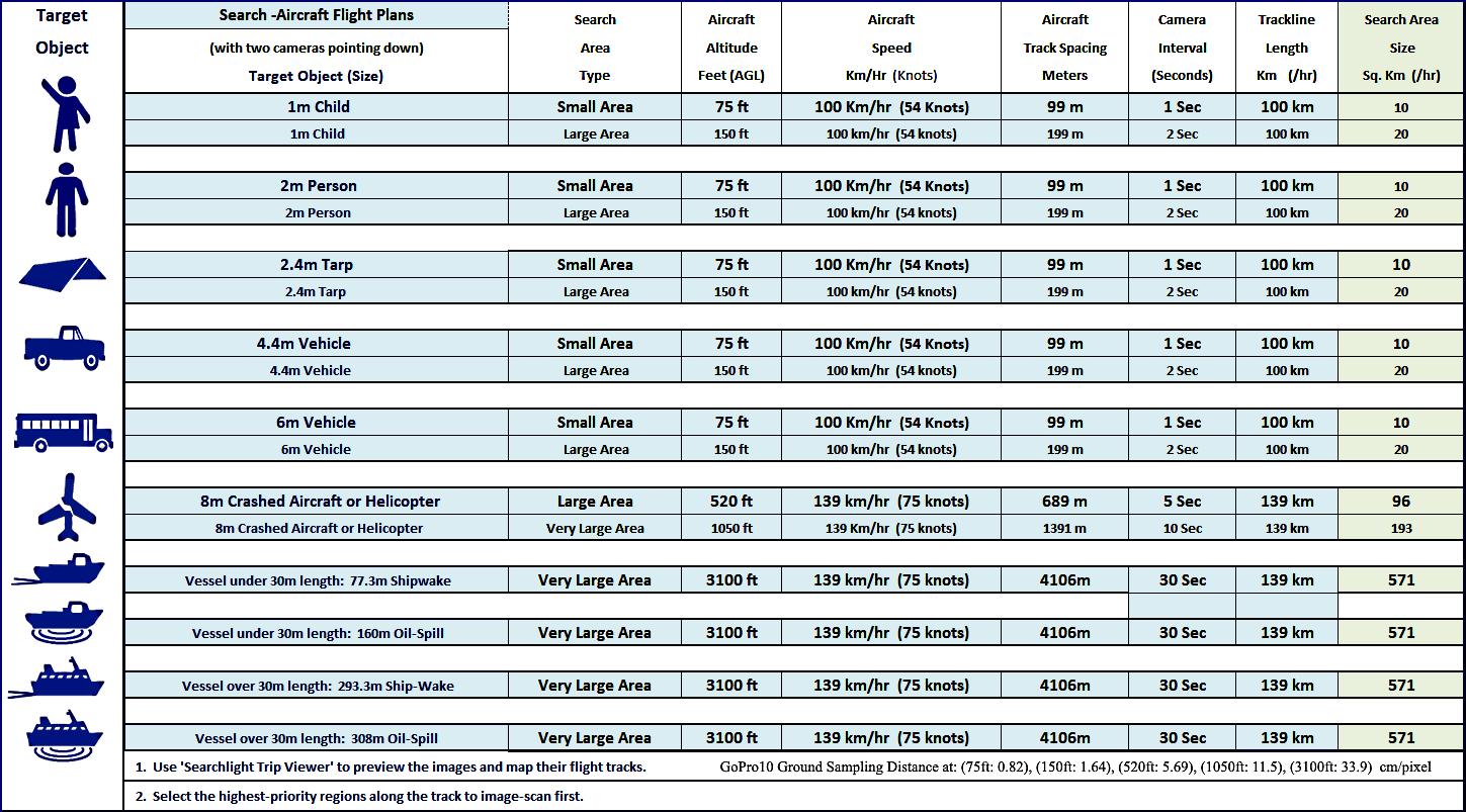
Image Recognition Flight Plan Search-Aircraft Flight Plan Search-Aircraft Flight Plan Aircraft Flight Plan Details - Looking for 8m Missing Aircraft & Helicopters - Looking for 8m Missing Aircraft & Helicopters for Search Aircraft - In Open or Mixed Terrain - In Forest with some Open Canopy ![]()
Aircraft Altitude: 500 ft Above Ground Level 520 ft Above Ground Level Aircraft Ground Search Speed: 139 km/hr (75 Knots) 139 km/hr (75 Knots) Aircraft Track Spacing: 1127 meters (3,697 feet) Spacing 689 meters (2,260 feet) Spacing Camera Orientation: 

Camera Default Mode: Time Lapse (Photo) GPS: On Left & Right Cameras Facing Forward Left & Right Cameras Facing Down Camera Single-Shot Time Lapse Interval: 2 Seconds 5 Seconds Interval 5 Seconds Interval Camera Total Horizontal Field of View: 135 Deg GoPro GSD (Resolution) at 500 ft AGL: 1.18 cm/pixel GoPro GSD (Resolution) at 520 ft AGL: 0.72 cm/pixel Megapixels: 12 MP. Format: 16x9 Wide, Zoom : 0% - Open/Mixed Terrain Area Coverage - - Forest Terrain Area Coverage - EV Comp: On -0.5,. ISO 100 min 1600 max 139 Km Total Track Length per Hour 139 Km Total Track Length per Hour Color: GoPro. White Balance: Auto 156.61 Sq Km Area Coverage per Hour 95.73 Sq Km Area Coverage per Hour Sharpness: High. High Dynamic Range: On 9 Images per Sq. Km 15 Images per Sq. Km Anti-Reflection: Shade, Black Cloth and Lens Hood 1,440 images per Hour 1,440 images per Hour
| Image Recognition Flight Plan | Search-Aircraft Flight Plan | Search-Aircraft Flight Plan |
|---|---|---|
| Aircraft Flight Plan Details | Looking for Missing Vessels Under 30 meters Long | Looking for Missing Vessels Over 30 meters Long |
| for Search Aircraft | Generating a 77m Ship-Wake or 160m Oil-Spill | Generating a 293m Ship-Wake or 308m Oil-Spill |
 |  | |
| Aircraft Altitude: | 995 ft Above Ground Level | 3,000 ft Above Ground Level |
| Aircraft Ground Search Speed: | 139 km/hr (75 Knots) | 139 km/hr (75 Knots) |
| Aircraft Track Spacing: | 2.24 Km (1.21 Nautical Miles) Spacing | 6.76 Km (3.65 Nautical Miles) Spacing |
| Camera Orientation: | | |
| Camera Default Mode: Time Lapse (Photo) GPS: On | Left & Right Cameras Facing Forward | Left & Right Cameras Facing Forward |
| Camera Single-Shot Time Lapse Interval: | 10 Seconds Interval | 30 Seconds Interval |
| Camera Total Horizontal Field of View: 135 Deg | GoPro GSD (Resolution) at 995 ft AGL: 2.34 cm/pixel | GoPro GSD (Resolution) at 3000 ft AGL: 7.06 cm/pixel |
| Megapixels: 12 MP. Format: 16x9 Wide, Zoom : 0% | Coastal and Maritime Waters | Coastal and Maritime Waters |
| EV Comp: On -0.5,. ISO 100 min 1600 max | 139 Km Total Track Length per Hour | 139 Km Total Track Length per Hour |
| Color: GoPro. White Balance: Auto | 312 Sq Km Area Coverage per Hour | 940 Sq Km Area Coverage per Hour |
| Sharpness: High. High Dynamic Range: On | 2 Images per Sq. Km | 0.3 Images per Sq. Km |
| Anti-Reflection: Shade, Black Cloth and Lens Hood | 720 images per Hour | 240 images per Hour |
![]()
![]() Search Helicopter Flight Plans:
Search Helicopter Flight Plans:
![]() Search-Helicopter Flight Plans – for Missing Persons and Vehicles
Search-Helicopter Flight Plans – for Missing Persons and Vehicles
![]() Quick Set-Up for Missing Persons
Quick Set-Up for Missing Persons
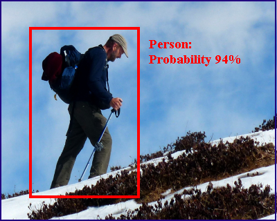
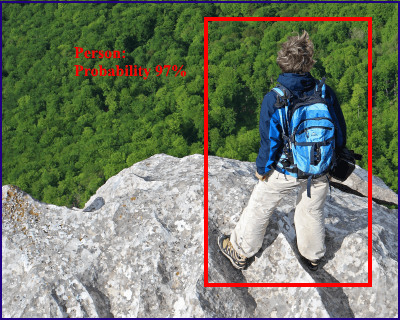
Image Recognition Flight Plan Search-Helicopter Flight Plan Search-Helicopter Flight Plan Helicopter Flight Plan Details - Looking for 2m Missing Persons - Looking for 2m Missing Persons for Search-Helicopters - In Open or Mixed Terrain - In Forest with some Open Canopy ![]()
Helicopter Altitude: 75 ft Above Ground Level 75 ft Above Ground Level Helicopter Ground Search Speed: 50 km/hr (31 miles/hr) (27 knots) 50 km/hr (31 miles/hr) (27 knots) Helicopter Track Spacing: 169 meters (544 feet) Spacing 99 meters (324 feet) Spacing Camera Orientation: Camera Default Mode: Time Lapse (Photo) GPS: On Left & Right Cameras Facing Forward Left & Right Cameras Facing Down Camera Single-Shot Time Lapse Interval: 2 Seconds 2 Seconds Interval 2 Seconds interval Camera Total Horizontal Field of View: 135 Deg GoPro GSD (Resolution) at 75 ft AGL: 0.18 cm/pixel GoPro GSD (Resolution) at 75 ft AGL: 0.10 cm/pixel Megapixels: 12 MP. Format: 16x9 Wide, Zoom : 0% - Open/Mixed Terrain Area Coverage - - Forest Terrain Area Coverage - EV Comp: On -0.5,. ISO 100 min 1600 max 50 Km Total Track Length per Hour 50 Km Total Track Length per Hour Color: GoPro. White Balance: Auto 8.45 Sq Km Area Coverage per Hour 4.97 Sq Km Area Coverage per Hour Sharpness: High. High Dynamic Range: On 426 Images per Sq. Km 725 Images per Sq. Km Anti-Reflection: Shade, Black Cloth and Lens Hood 3,600 images per Hour 3,600 images per Hour
![]() Search-Helicopter Flight Plans – for Missing Vehicles
Search-Helicopter Flight Plans – for Missing Vehicles
![]() Quick Set-Up for Missing Vehicles
Quick Set-Up for Missing Vehicles
Image Recognition Flight Plan Search-Helicopter Flight Plan Search-Helicopter Flight Plan Helicopter Flight Plan Details - Looking For 6m Missing Vehicles - Looking for 6m Missing Vehicles for Search-Helicopters - In Open or Mixed Terrain - In Forest with some Open Canopy ![]()
Helicopter Altitude: 200 ft Above Ground Level 200 ft Above Ground Level Helicopter Ground Search Speed: 80 km/hr (50 miles/hr) (43 knots) 50 km/hr (31 miles/hr) (27 knots) Helicopter Track Spacing: 451 meters (1480 feet) Spacing 265 meters (869 feet) Spacing Camera Orientation: Camera Default Mode: Time Lapse (Photo) GPS: On Left & Right Cameras Facing Forward Left & Right Cameras Facing Down Camera Single-Shot Time Lapse Interval: Seconds 5 Seconds Interval 2 Seconds interval Camera Total Horizontal Field of View: 135 Deg GoPro GSD (Resolution) at 200 ft AGL: 0.47 cm/pixel GoPro GSD (Resolution) at 200 ft AGL: 0.28 cm/pixel Megapixels: 12 MP. Format: 16x9 Wide, Zoom : 0% - Open/Mixed Terrain Area Coverage - - Forest Terrain Area Coverage - EV Comp: On -0.5,. ISO 100 min 1600 max 80 Km Total Track Length per Hour 50 Km Total Track Length per Hour Color: GoPro. White Balance: Auto 36.06 Sq Km Area Coverage per Hour 13.25 Sq Km Area Coverage per Hour Sharpness: High. High Dynamic Range: On 40 Images per Sq. Km 109 Images per Sq. Km Anti-Reflection: Shade, Black Cloth and Lens Hood 1,442 images per Hour 1,444 images per Hour
![]() Search-Drone Flight Plans – for Missing Persons
Search-Drone Flight Plans – for Missing Persons
![]() Quick Set-Up for Missing Persons
Quick Set-Up for Missing Persons
Tip: Aircraft Track-Spacing Reduction for Side-Hill (Contour) searching:
Image Recognition Flight Plan Search-Drone Flight Plan Search-Drone Flight Plan Drone Flight Plan Details - Looking for 2m Missing Persons - Looking for 2m Missing Persons for Search-Drones - In Open or Mixed Terrain - In Forest with some Open Canopy 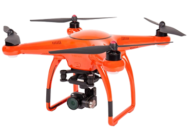
Drone Altitude: 75 ft Above Ground Level 105 ft Above Ground Level Drone Ground Search Speed: 50 km/hr (31 miles/hr) (27 knots) 50 km/hr (31 miles/hr) (27 knots) Drone Track Spacing: 48.6 meters (159 Feet) Spacing 40 meters (131 Feet) Spacing Camera Orientation: 

Camera Default Mode: Time Lapse (Photo) GPS: On Single Camera Facing Forward Single Camera Facing Down Camera Single-Shot Time Lapse Interval: 2 Seconds Interval 2 Seconds Interval Camera Total Horizontal Field of View: 69.5 Deg GoPro GSD (Resolution) at 75 ft AGL: 0.18 cm/pixel GoPro GSD (Resolution) at 75 ft AGL: 0.10 cm/pixel Megapixels: 12 MP. Format: 16x9 Wide, Zoom : 0% - Open/Mixed Terrain Area Coverage - - Forest Terrain Area Coverage - EV Comp: On -0.5, ISO 100 min 1600 max 25 Km Total Track Length per Half-Hour 25 Km Total Track Length per Half-Hour Color: GoPro. White Balance: Auto 1.21 Sq Km Area Coverage per Half-Hour 1.00 Sq Km Area Coverage per Half-Hour Sharpness: High. High Dynamic Range: On 741 Images per Sq. Km 626 Images per Sq. Km Anti-Reflection: Shade, Black Cloth and Lens Hood 900 images per Half-Hour 900 images per Half-Hour
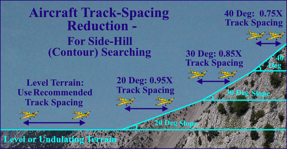
 Image Recognition Flight Plan – Aircraft/Helicopter GoPro Parts List
For more information please Contact SAR Technology Inc.